

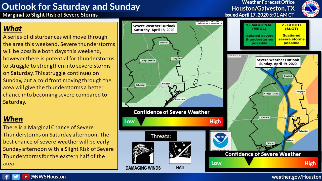
Showers thunderstorms will be possible this afternoon, Saturday afternoon, and Sunday. There is a chance of severe thunderstorms developing this weekend with Sunday having the better chance.

Overview
There will be multiple disturbances moving through the area over the next few days bringing showers and thunderstorms possible each day through Sunday. Today will be mainly showers and isolated thunderstorms as a weak cold front moves southwards across the area, but there is a threat of severe weather on both Saturday and Sunday. The potential on Saturday is lower (Marginal Risk) because storms will struggle to strengthen, however, if they do they will have the potential to produce locally heavy rainfall, lightning, hail, and gusty winds. The main threat on Saturday looks to remain north of the City of Houston.
The potential on Sunday is higher (up to a Slight Risk) due to a cold front moving through providing some better support to help the thunderstorms develop. The cold front is expected to move through the area in the late morning and afternoon from west to east, and once it moves through the severe threat will be over. The threats on Sunday will be similar to Saturday with storms having the potential to produce locally heavy rain, lightning, hail, and gusty winds. The City of Houston is in a Slight Risk on Sunday, but the best potential for severe weather will be east of the City


