

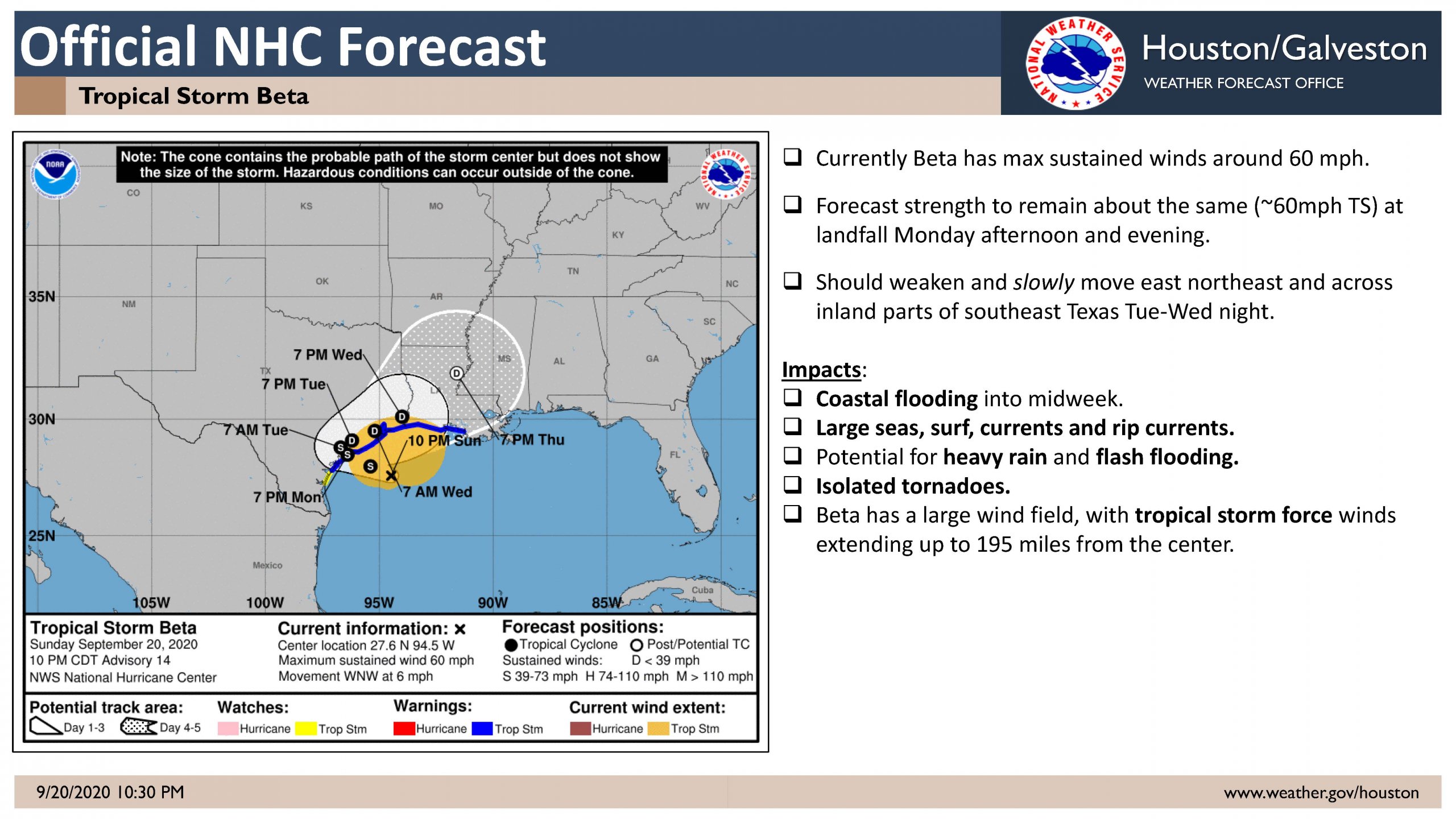
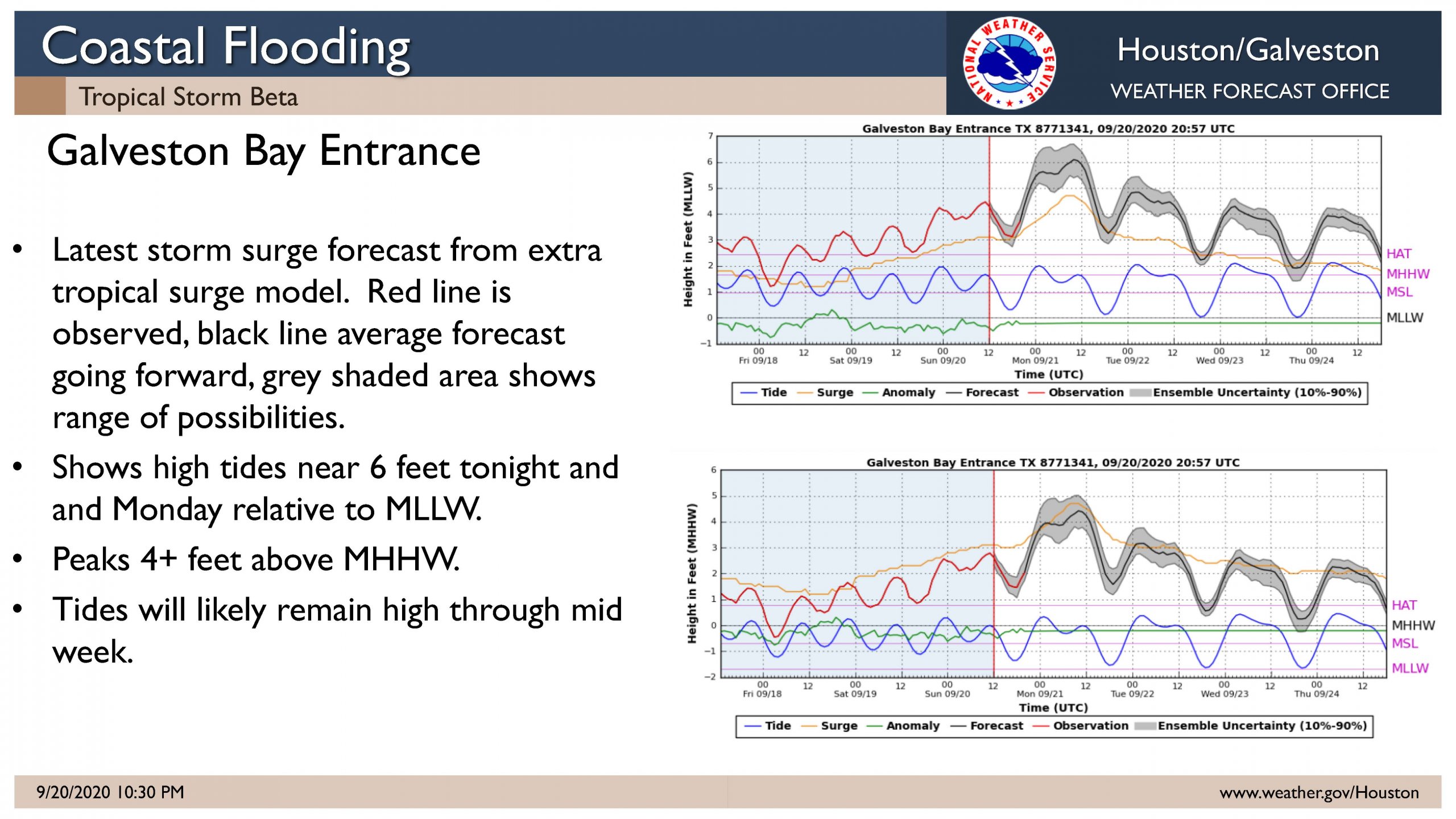
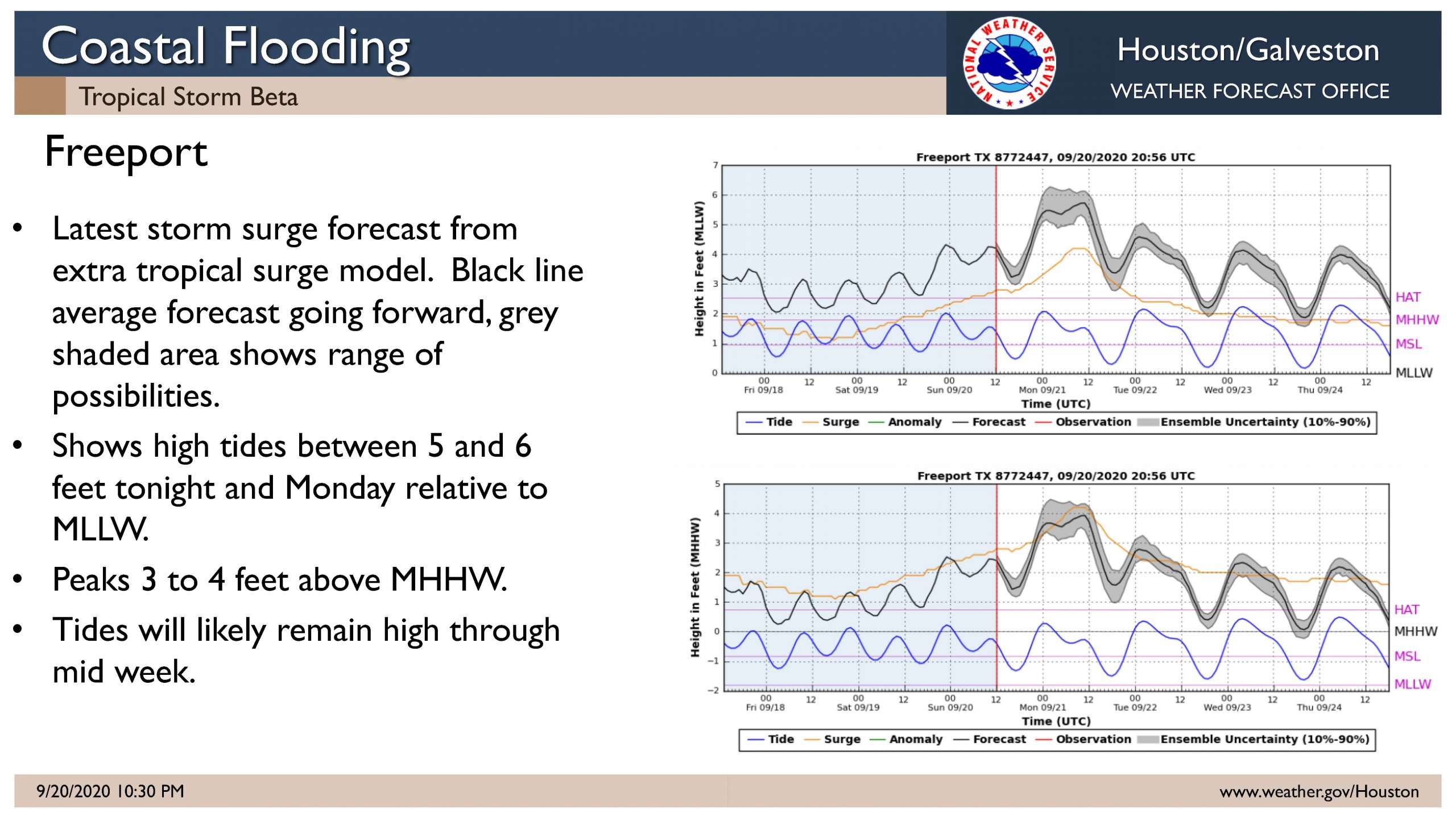
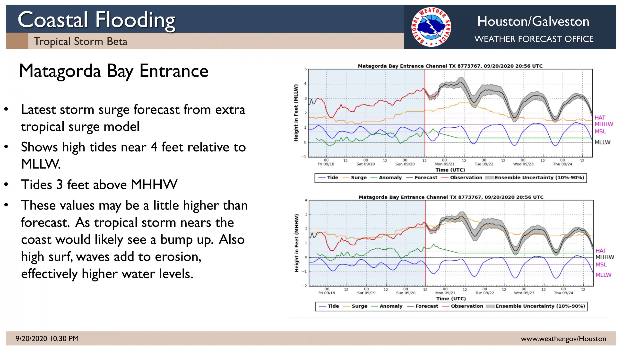
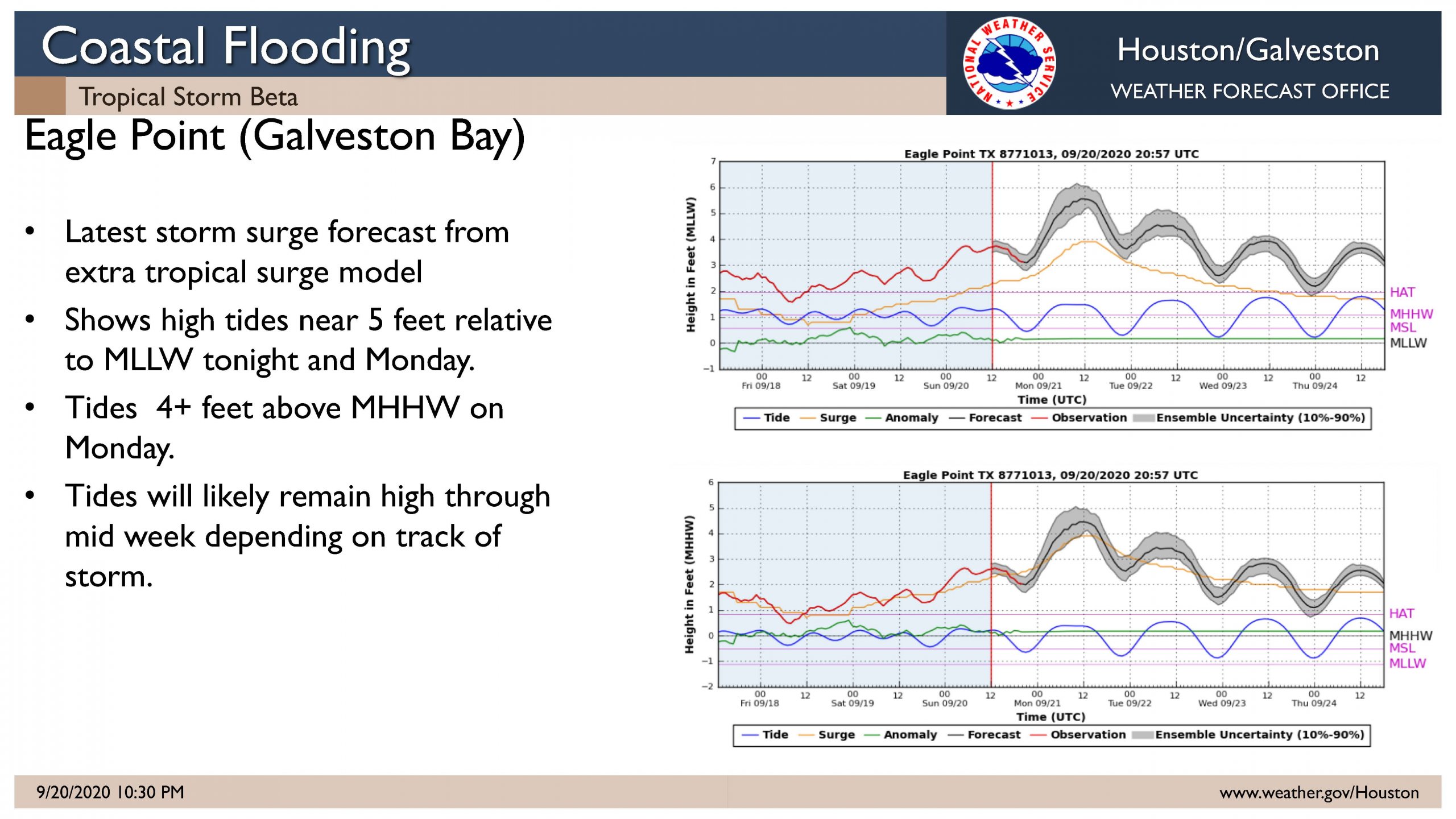
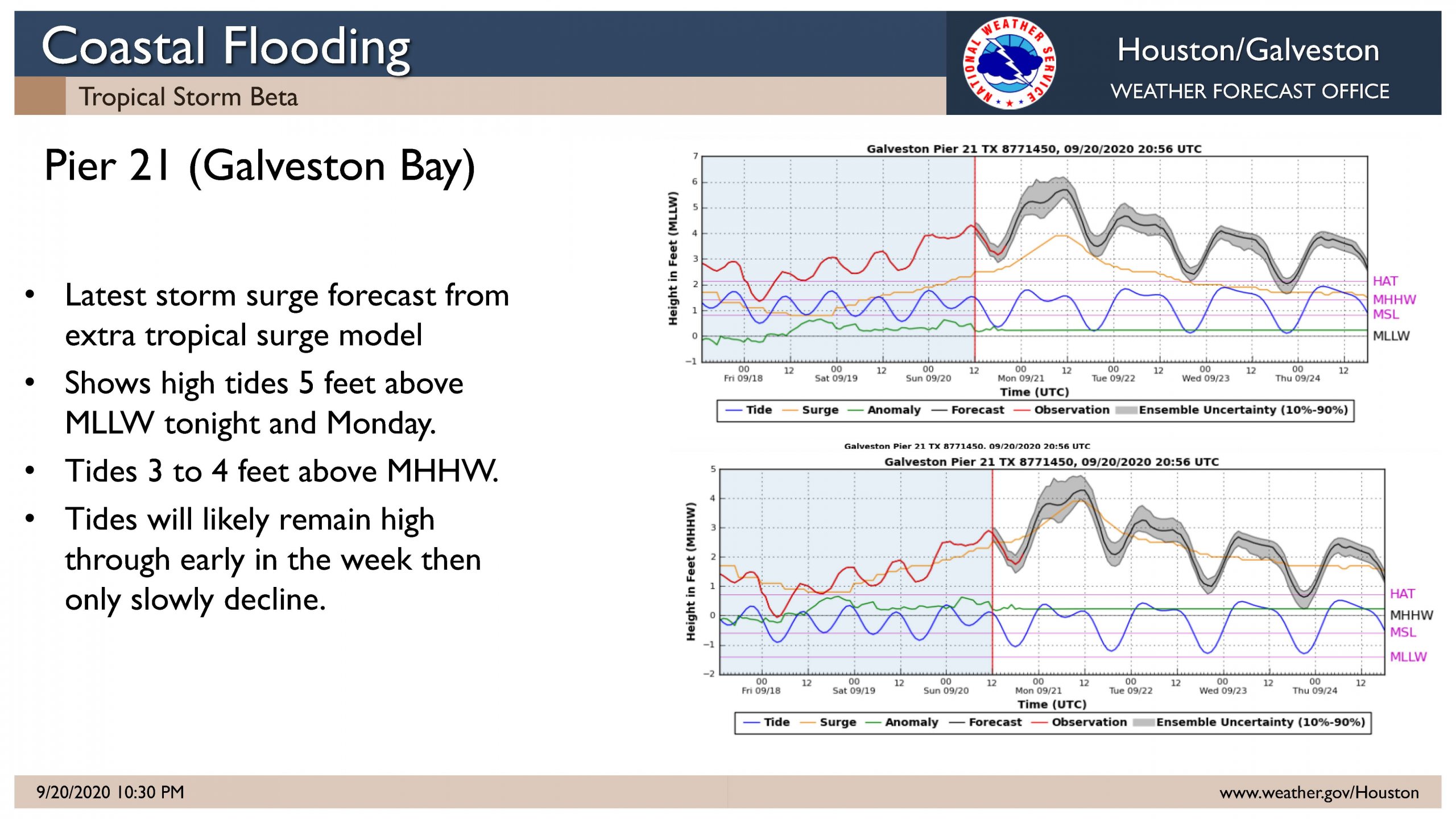
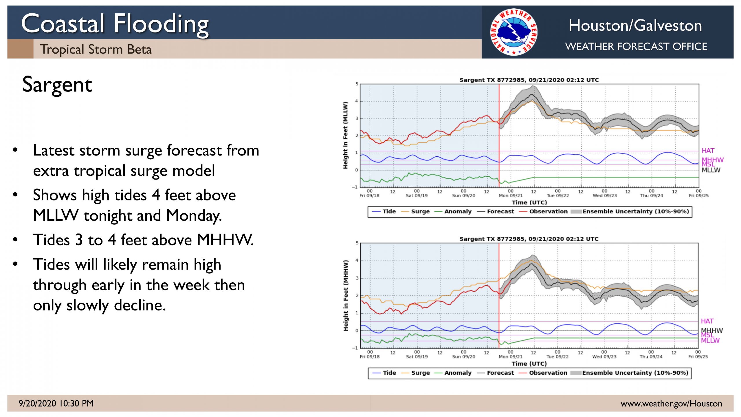
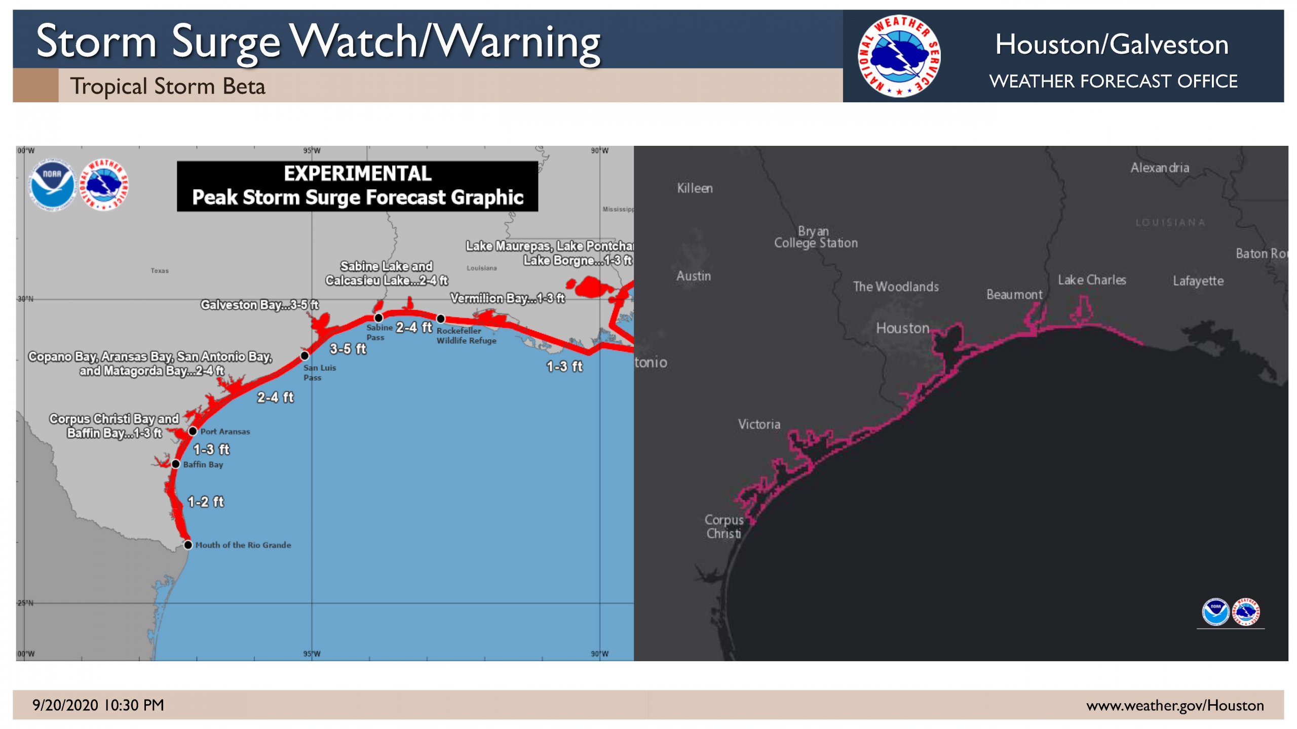
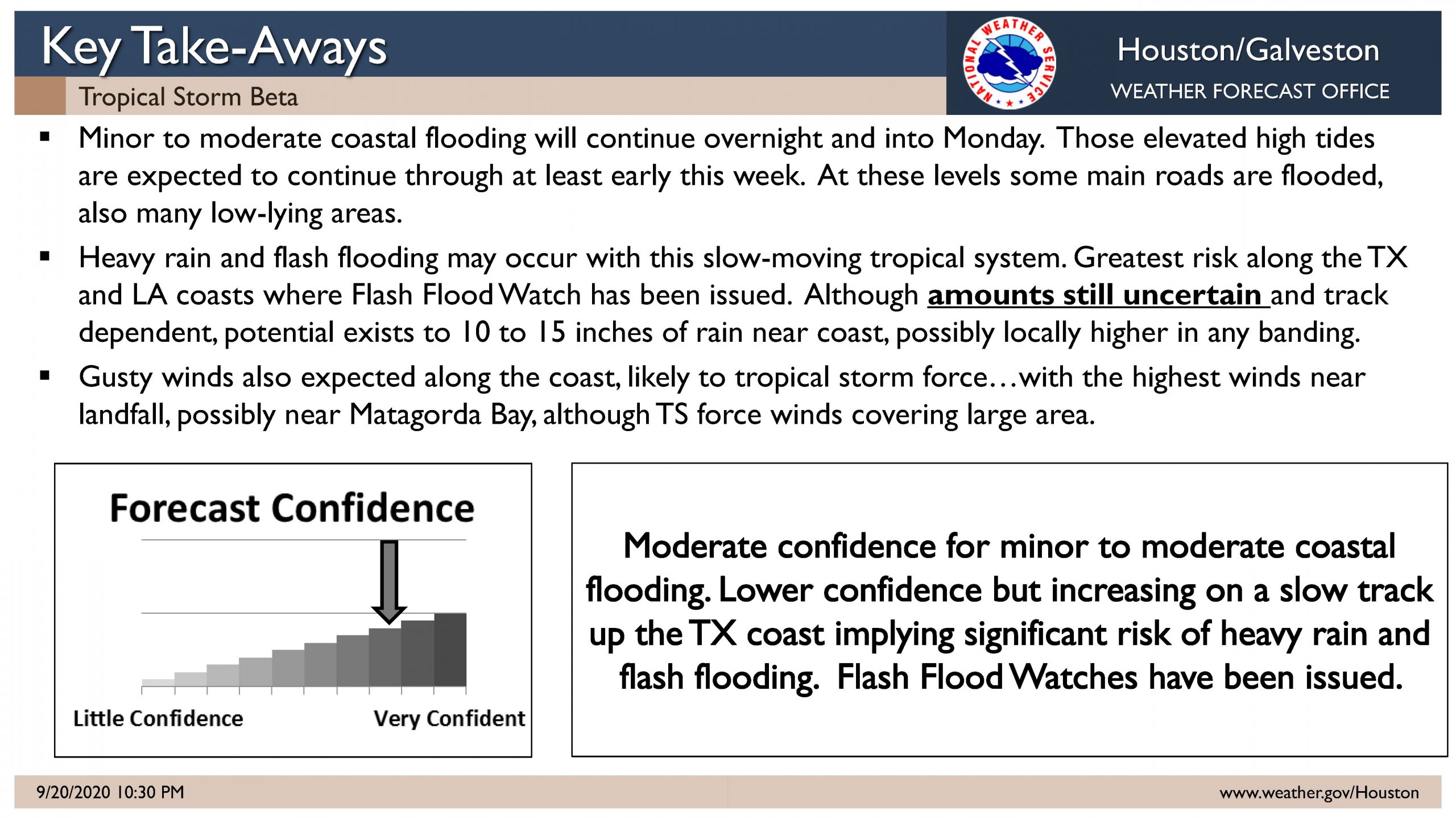
Extended periods of moderate coastal flooding along Bays and Gulf will occur tonight and Monday. Some roads on the Islands and near the Gulf and Bays will be flooded and impassable. Low lying areas will be flooded.

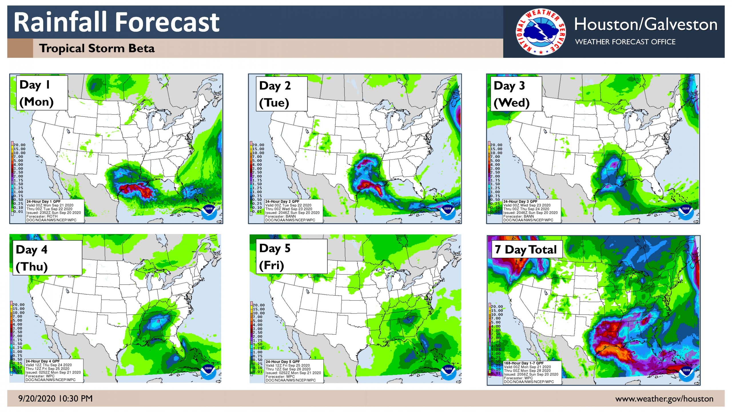
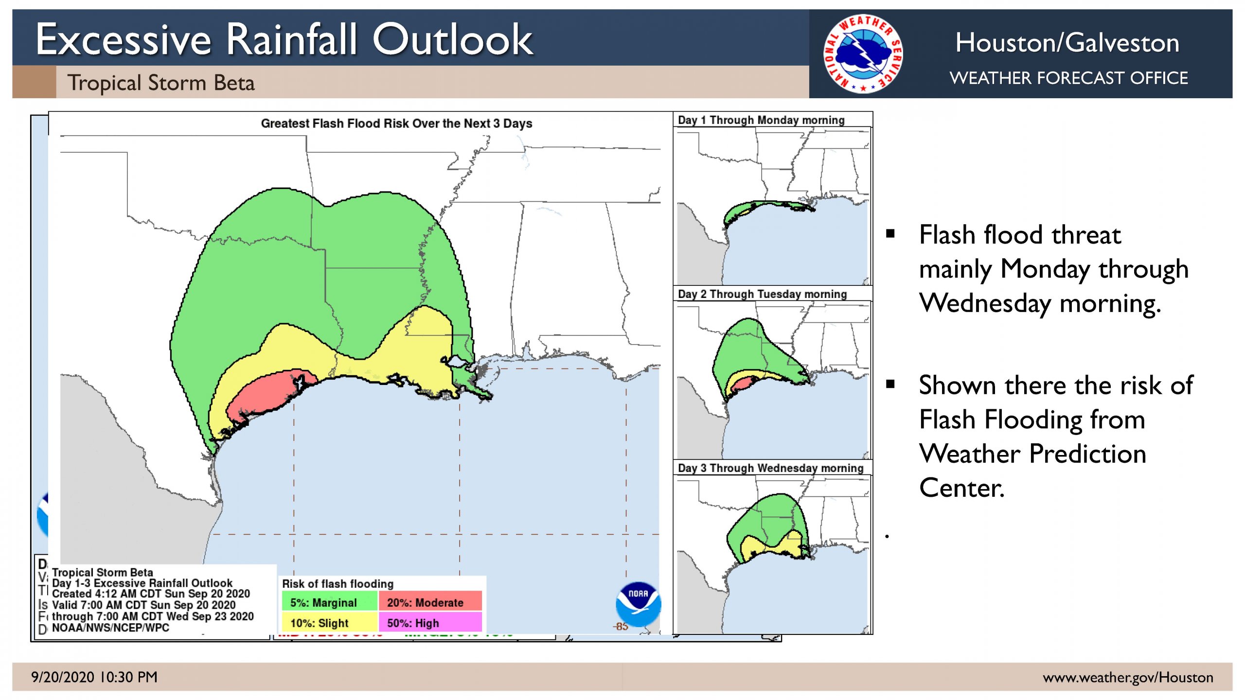
Heavy rain and flash flooding may occur with this slow-moving tropical system. The greatest risk will be along the TX and LA coasts where Flash Flood Watch has been issued. The amounts will be dependent on the eventual track of Beta and if training can develop over the region. Excessive rain could develop late tonight into Monday with threat continuing into Wednesday. Rainfall amounts remain a very uncertain part of forecast but the potential exists for 6 to 12 inches, locally 15 inches, over the 2 to 3 day period.
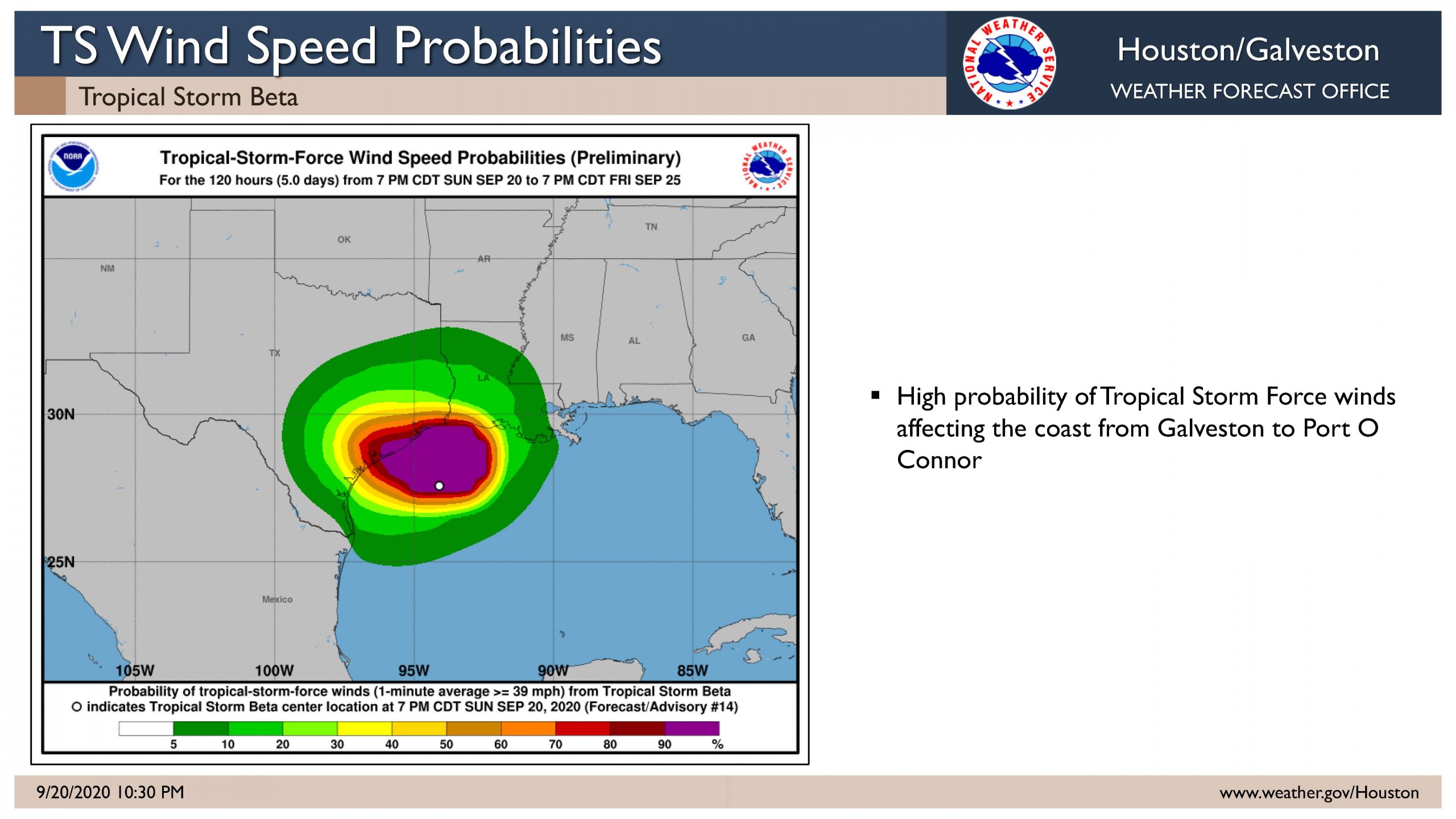
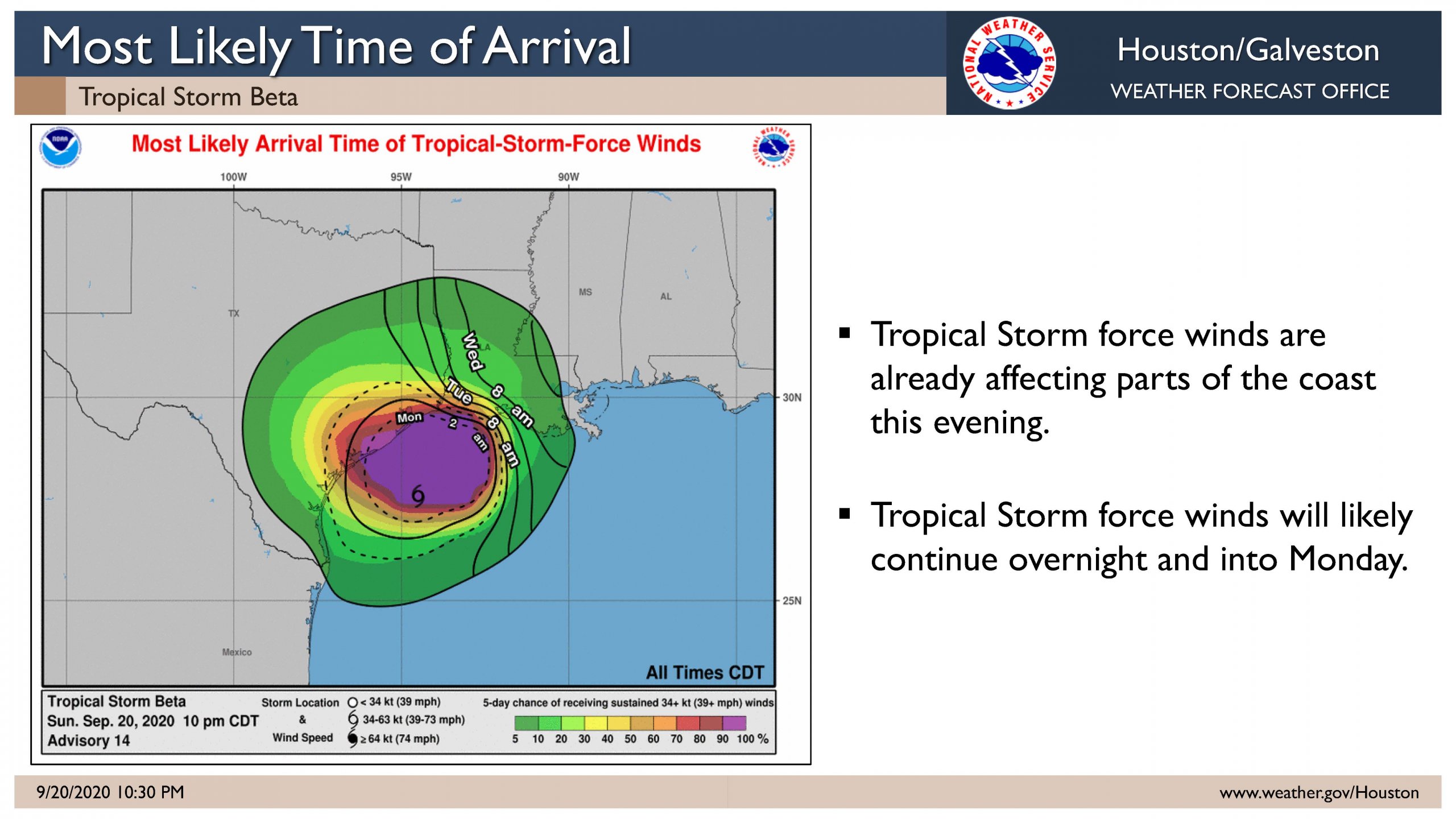
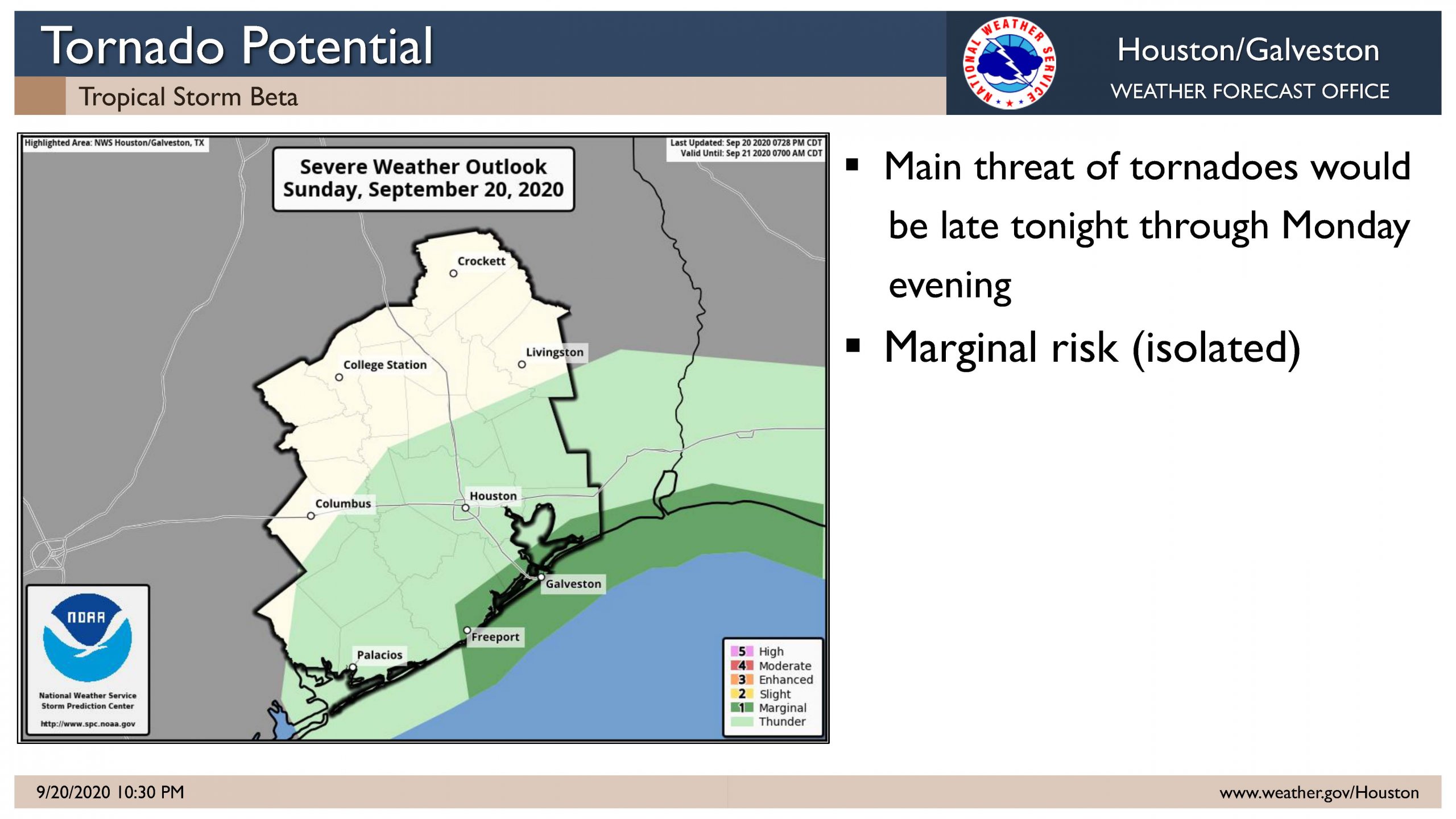
Gusty winds also expected along the coast, likely to tropical storm force…with the highest winds near landfall, possibly near or up the coast from Matagorda Bay. Isolated tornadoes and waterspouts will be possible.
The storm is forecast to track NE of the area on Wednesday with conditions improving then.


