

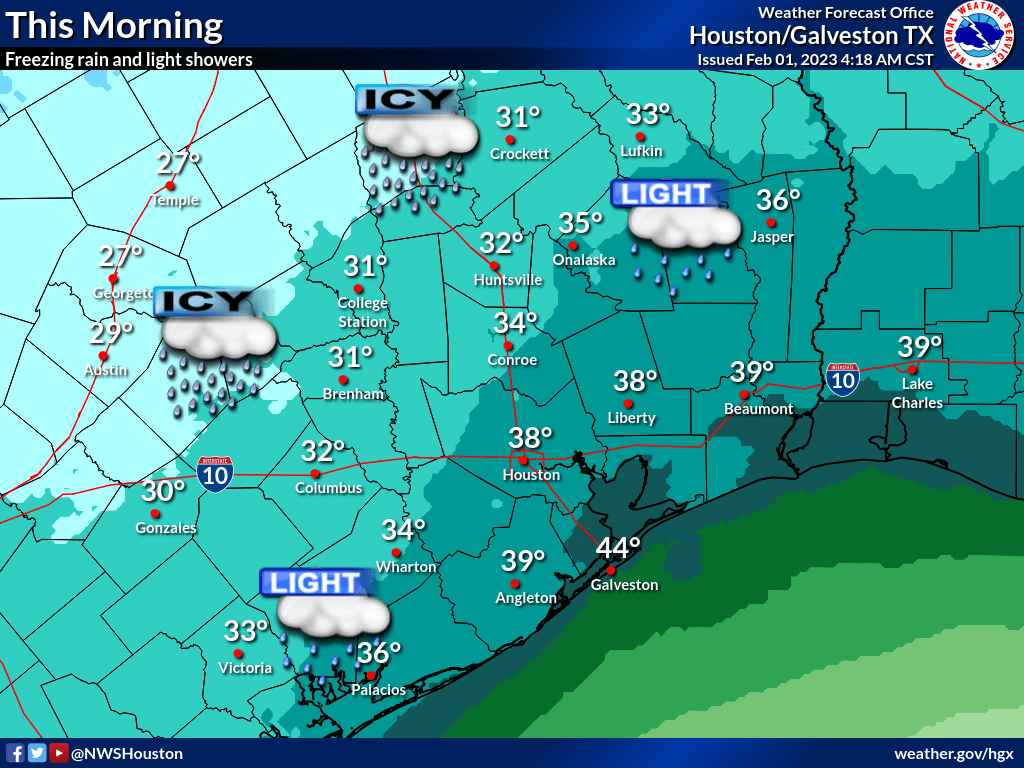
Freezing rain/drizzle is ongoing across our northwestern and northern counties. Ice accumulation should continue this morning, creating dangerous travel conditions on roadways. In addition to that, there will be a marginal risk of excessive rainfall tonight into Thursday Morning.

- Periods of light rainfall and drizzle are ongoing and should continue through the morning.
- Temperatures across our northern/northwestern counties are expected to be around and below freezing during this time period.
- This shallow, Arctic air mass is currently creating freezing rain/drizzle across our north/northwestern counties.
-
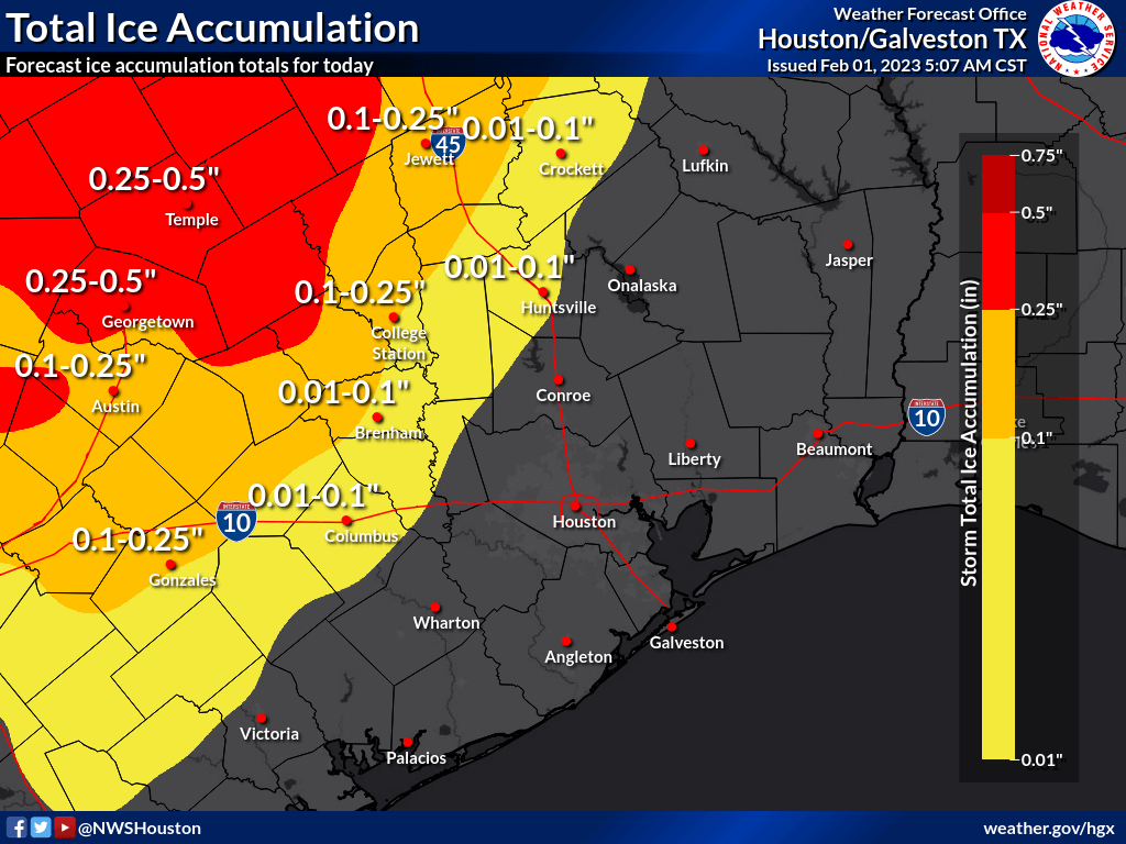
- The greatest icing potential remains focused further north and west towards Central and North Texas.
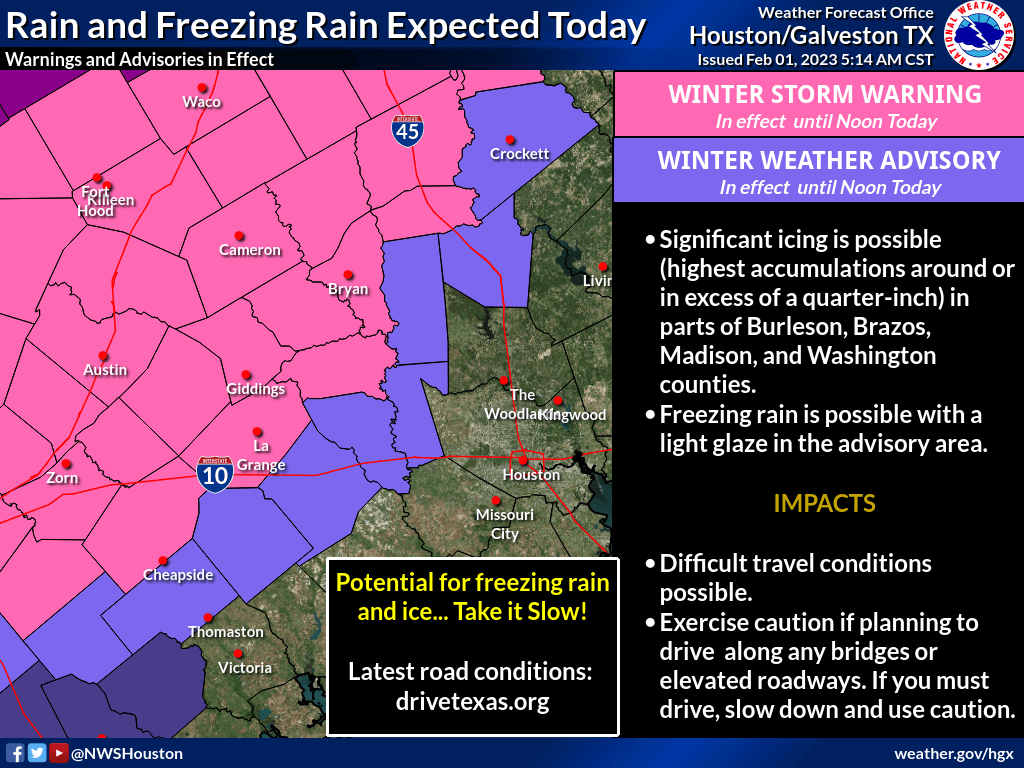
- A Winter Weather Advisory is in effect until noon today for the following locations:
- Colorado, Austin, Waller, Grimes, Walker and Houston Counties
- These areas could receive a light glaze of ice, causing hazardous travel conditions (especially on bridges, overpasses).
- A Winter Storm Warning is in effect for until noon today the following locations:
- Burleson, Washington, Brazos and Madison Counties
- These areas could receive upwards of 0.1″ – 0.35″ of additional ice accumulation, creating dangerous travel conditions and causing numerous power outages.
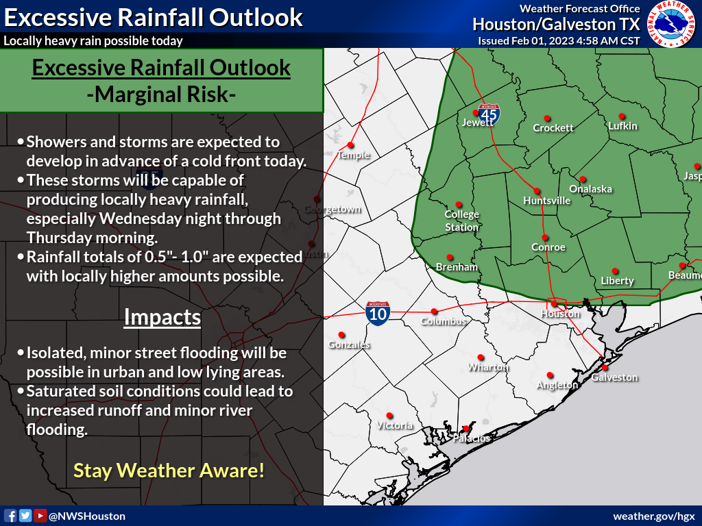
Excessive Rainfall Potential (late Wednesday into Thursday)
The winter weather threat is expected to end this afternoon. However, periods of light to moderate rainfall will be possible later in the day and especially tonight into Thursday morning. Though widespread rainfall totals are expected to be manageable, recent rains have saturated the soil in some areas which will increase runoff and the potential for minor river flooding. There will also be the risk of isolated, minor street flooding in urban and low-lying areas.
Urban Flash Flood Messaging
Locally heavy rainfall possible forecast for portions of Southeast Texas, including highly urbanized areas like the Houston metropolitan area. Based on forecast conditions, NWS Houston will be utilizing the following urban flash flood messaging for this event:
– Drive with caution. Isolated flooding could occur in low-lying areas. Ponding on roadways may increase risk of hydroplaning.
– Pay attention to the weather. Monitor the NWS, your local media, HCFCD and other official weather information sources.
– Rain may move repeatedly across the same area, causing a rapid rise on creeks and bayous. However, creeks and bayous are not likely to exceed their banks.


